Features
Everything it does
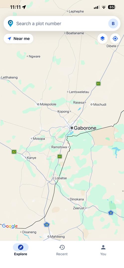
PlotFinder is one map with a search box on it. Everything below happens on that one screen, because a plot you are trying to find is not a reason to navigate a menu.
Search
By plot number, and by where you stand
Type a plot number and the map goes to it. Or tap Near me and PlotFinder reads your position once and lists the registered plots around you, nearest first — which is how you work out what the plot next door is called.
- Results carry the town and the district, so you can tell two matches apart.
- The pin lands on the plot, not on the middle of the suburb.
- Recently opened plots are kept, so going back to one is a tap.
Every match
Because the number is not unique
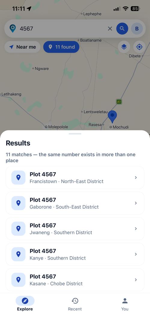
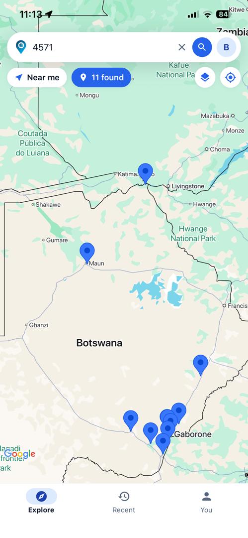
The same plot number exists in more than one place in Botswana — across towns, and sometimes within one town at addresses kilometres apart. An app that returns a single result for “4567” is guessing, and it will be wrong often enough to send somebody to the wrong district.
PlotFinder returns all of them, on the map and in a list, and lets you pick. This is the feature the whole product is built around.
The map
Street level, or the whole country
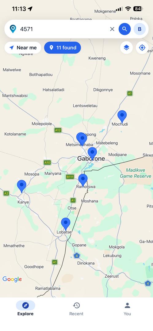
Zoom out and the matches sit across Botswana from Kasane to Gaborone; zoom in and you are on the plot. Satellite imagery is a toggle away when you want to see what is actually on the ground, with the roads still labelled over it — an unlabelled aerial photo is very hard to read in a town you do not know.
- Satellite and standard views.
- Street View at the pin, when Google has coverage there.
- Your own position on the map, when you allow it.
Directions
Handed to the app you already use
Pick a plot, see the route and the distance, then send it to Google Maps or Waze to actually drive it. PlotFinder does not try to be a navigation app: those two already know the traffic, the road closures and your voice preference, and nothing is gained by us pretending otherwise.
Written steps come with the preview, folded away until you ask for them. The plot you are routing from is drawn in green, so which way the journey runs is obvious — two identical pins with a line between them are not.
Your plan
What you can search, in one place
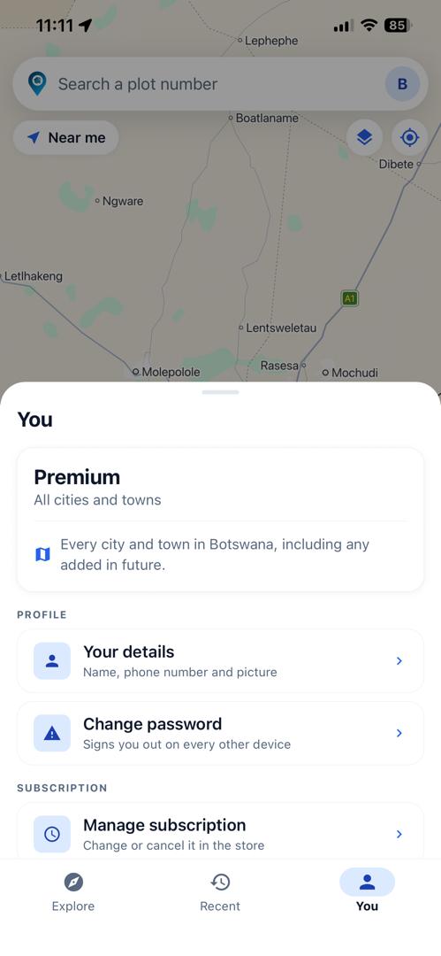
The account screen says which towns your plan covers and nothing more cryptic than that. Your details, your password and your subscription are all one tap from it.
Changing or cancelling a subscription happens in the App Store or Google Play, and the row here takes you straight there — neither store lets an app do it on your behalf. How the plans work.
Signing in, and leaving
Sign in how you like
An email address and password, or Sign in with Apple, or Continue with Google. All three reach the same account.
Your details, yours to change
Display name, phone number and picture — all optional, all clearable. Your email address is the login and stays fixed.
Leave whenever
Delete your account and everything attached to it from inside the app, or ask us after you have uninstalled it.